 ORNIX
Route, piste et hors piste, même sans réseauRoad, track and off-road, even with no signal
Ornix est une appli de navigation Android sur cartes OpenStreetMap, pour la marche, le vélo, la moto et la voiture. Elle guide vers une adresse, suit vos tracés GPX et fonctionne hors ligne. Voici l'essentiel pour bien démarrer.Ornix is an Android navigation app on OpenStreetMap maps, for walking, cycling, motorbikes and cars. It guides you to an address, follows your GPX tracks and works offline. Here is all you need to get going.
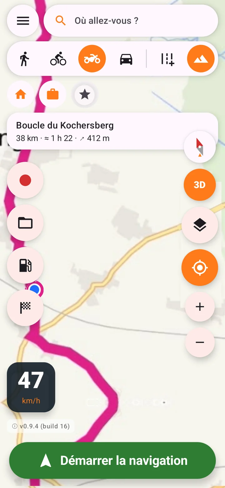
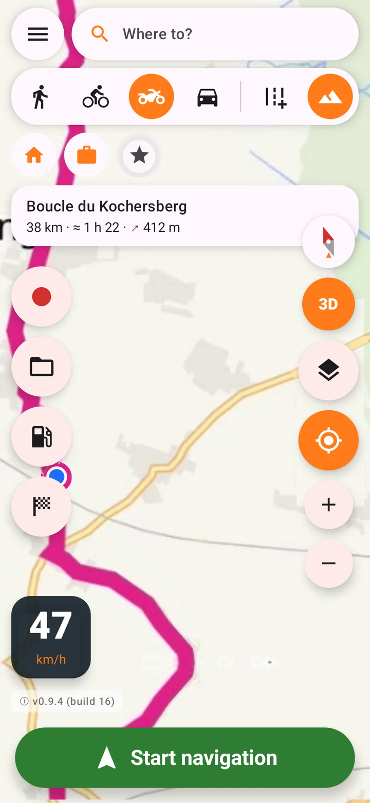
En 6 étapesIn 6 steps
- 1
Autoriser la positionAllow location
Au premier lancement, après l'animation d'accueil, acceptez l'accès à la position « Lorsque l'appli est utilisée ». Sans elle, ni le point bleu ni le guidage ne fonctionnent.
On first launch, after the welcome animation, allow location access "While using the app". Without it, there is no blue dot and no guidance.
L'écran reste allumé tant qu'Ornix est ouverte : pratique sur le guidon. Langue (français ou anglais) et unités (km ou miles) suivent le téléphone ; changez-les dans le menu ☰.
The screen stays on while Ornix is open, handy on the handlebars. Language (French or English) and units (km or miles) follow your phone; change them in the menu ☰.
- 2
Choisir le mode et le terrainPick your mode and terrain
Sous la recherche, touchez votre mode : 🚶 piéton, 🚲 vélo, 🏍️ moto ou 🚗 voiture. Puis le terrain : Route pour rester sur les routes, ou l'icône montagne Rando / hors piste pour accepter pistes et chemins.
Under the search bar, tap your mode: 🚶 walking, 🚲 bike, 🏍️ motorbike or 🚗 car. Then the terrain: Road to stay on roads, or the mountain icon Trail / off-road to allow tracks and paths.
Le mode règle l'itinéraire, l'alerte hors tracé (30 m à pied, 40 m à vélo, 50 m en moto et voiture) et l'estimation de durée.
The mode sets the routing, the off-track warning (30 m on foot, 40 m by bike, 50 m by motorbike and car) and the time estimate.
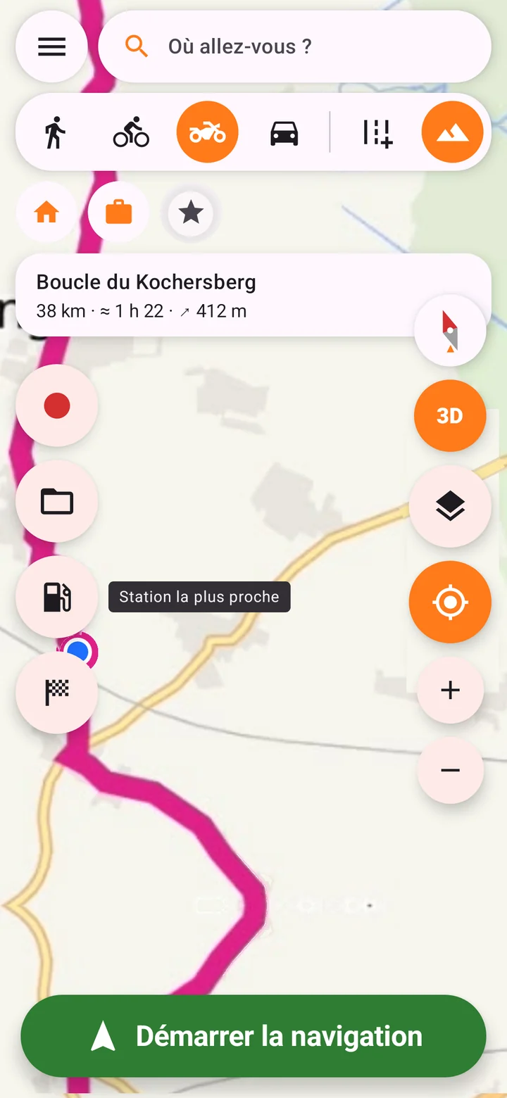
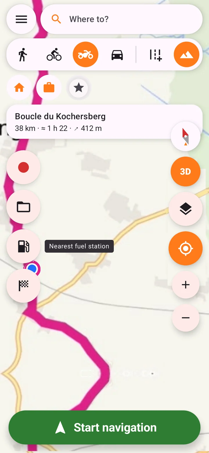
Astuce : un appui long sur un bouton dit à quoi il sert.Tip: press and hold any button to see what it does. - 3
Aller quelque partGo somewhere
Touchez Où allez-vous ? et tapez une adresse, une ville ou un lieu. Vous pouvez aussi toucher un raccourci (Domicile, Travail, Mon lieu), un favori ★, ou faire un appui long sur la carte puis Aller ici.
Tap Where to? and type an address, a town or a place. You can also tap a shortcut (Home, Work, My place), a favourite ★, or press and hold the map and tap Go here.
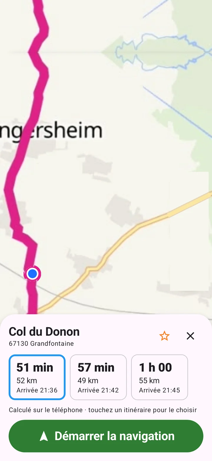
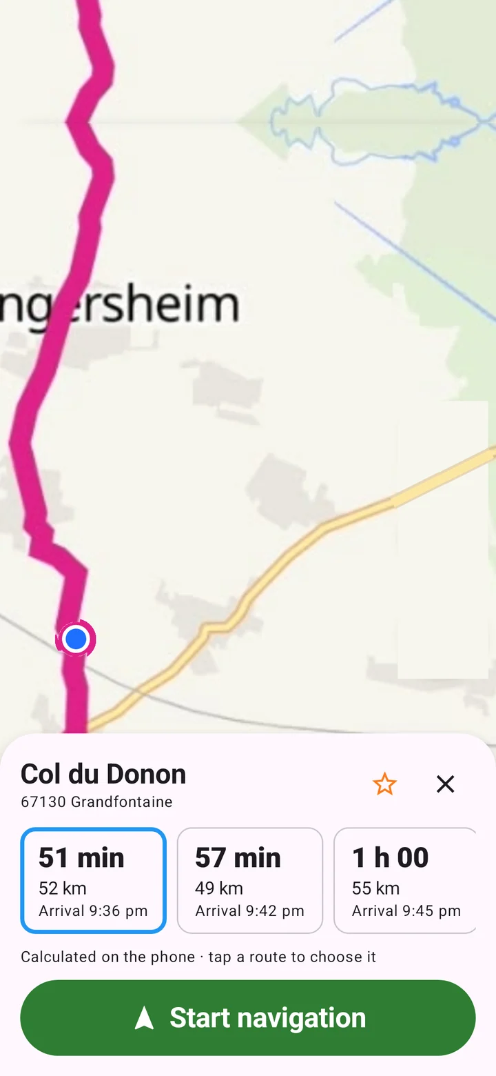
Ornix propose jusqu'à 3 itinéraires avec durée, distance et heure d'arrivée. Touchez celui qui vous plaît, puis Démarrer la navigation.
Ornix offers up to 3 routes with time, distance and arrival time. Tap the one you like, then Start navigation.
- 4
Suivre un tracé GPXFollow a GPX track
Touchez le dossier 📁 à gauche et choisissez votre fichier GPX. Le tracé s'affiche avec départ, arrivée, points et flèches de sens. Touchez Démarrer la navigation.
Tap the folder 📁 on the left and pick your GPX file. The track appears with its start, finish, waypoints and direction arrows. Tap Start navigation.
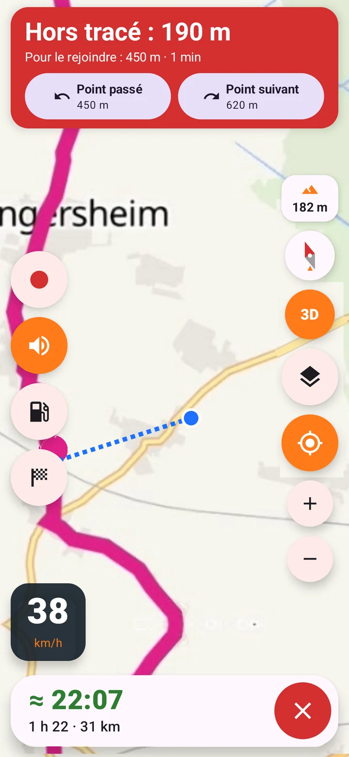
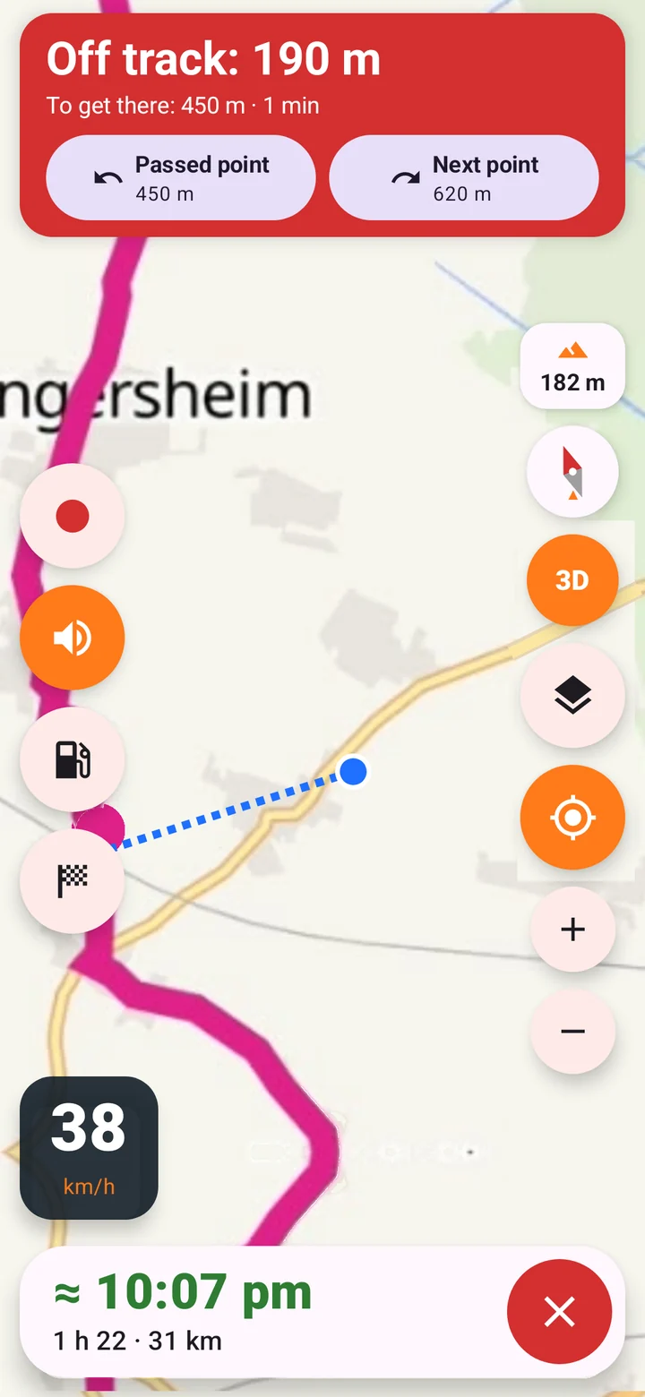
Si vous quittez le tracé, le bandeau passe au rouge et deux boutons vous ramènent : Point passé ou Point suivant, avec leur distance.
If you leave the track, the banner turns red and two buttons take you back: Passed point or Next point, with their distance.
- 5
Télécharger les cartes avant de partirDownload maps before you leave
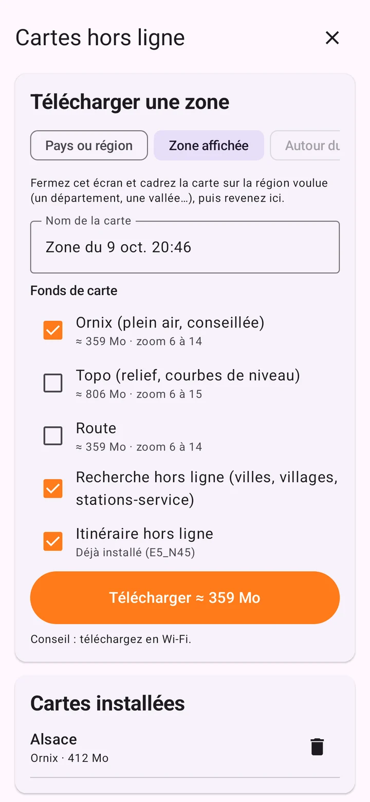
À la maison, en Wi-Fi : menu ☰ → Cartes hors ligne → Pays ou région. Tapez par exemple « Aquitaine », choisissez le résultat et laissez cochés la carte Ornix, la recherche hors ligne et l'itinéraire hors ligne. Touchez Télécharger.
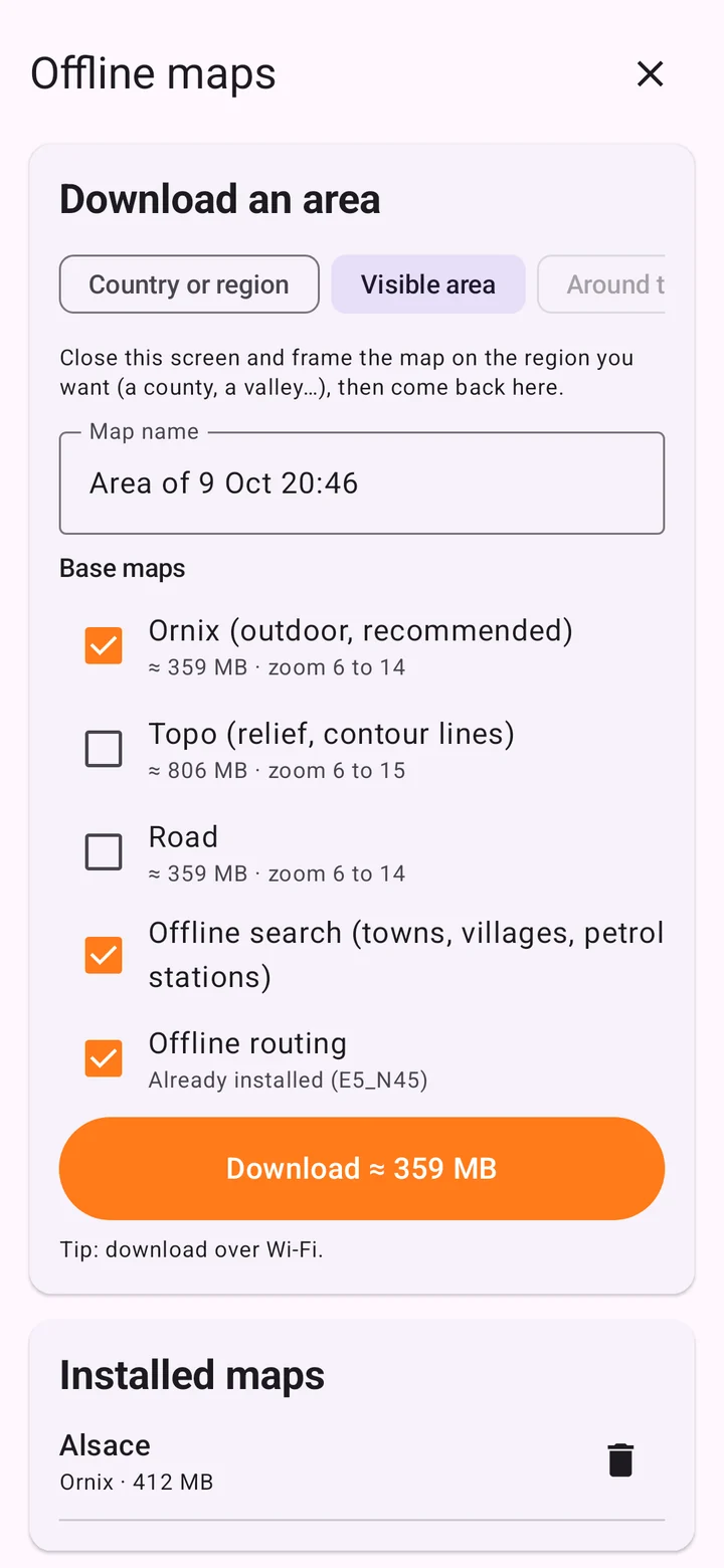
At home, on Wi-Fi: menu ☰ → Offline maps → Country or region. Type, say, "Tyrol", pick the result and leave the Ornix map, offline search and offline routing ticked. Tap Download.
Ensuite, carte, recherche et itinéraire marchent sans réseau. Vérifiez-le en mode avion avant de partir.
Map, search and routing then work with no signal. Check it in flight mode before you go.
- 6
Passer en mode rallyeSwitch to rally mode
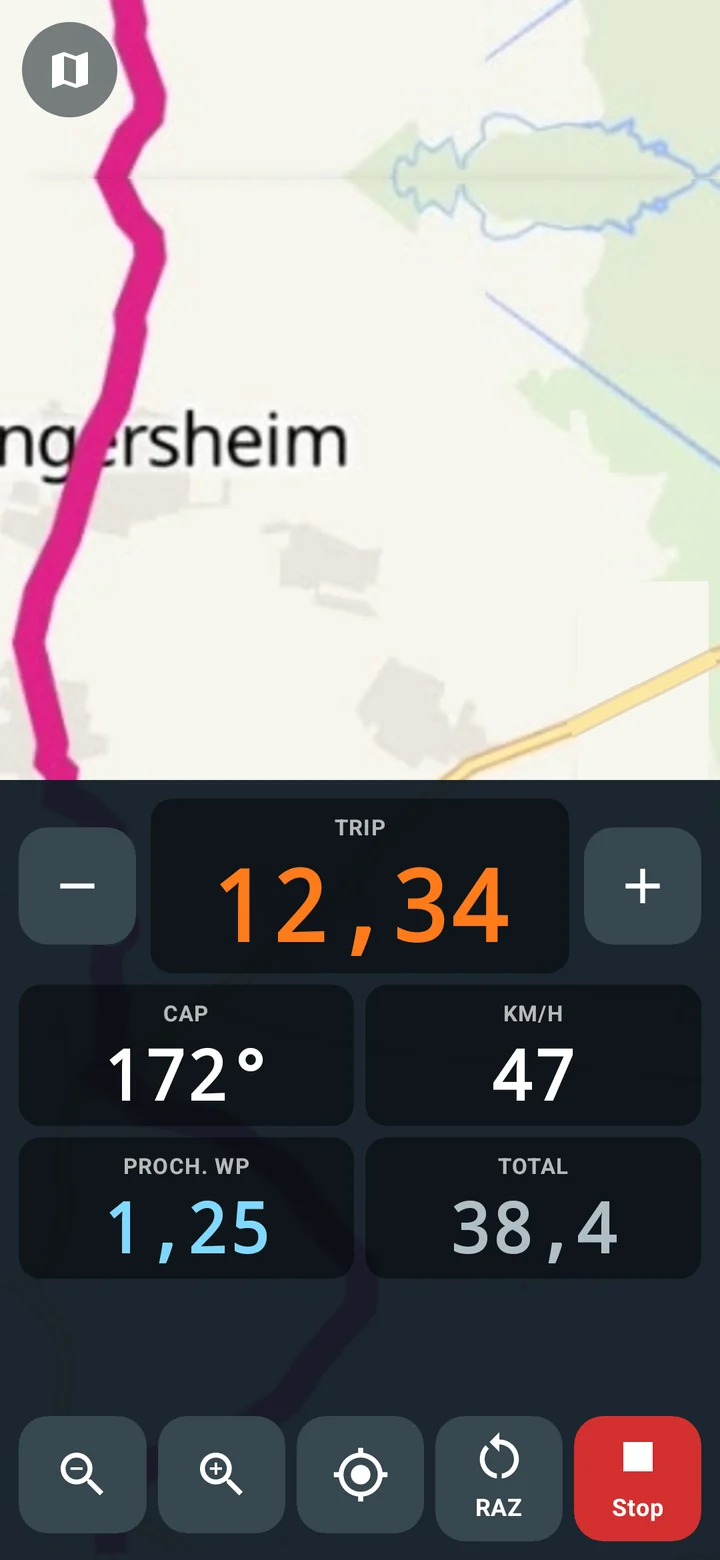
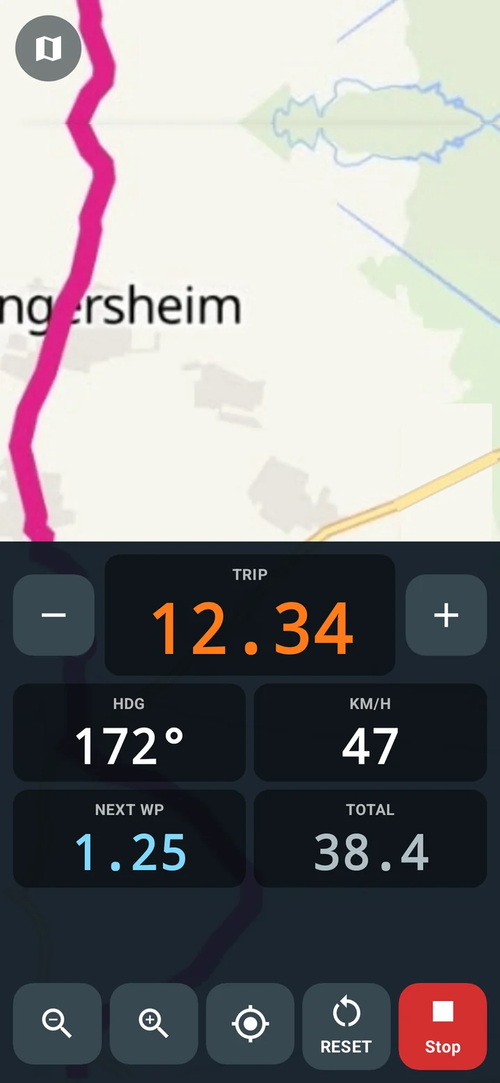
Le drapeau à damier 🏁 à gauche ouvre l'écran rallye, sans arrêter la navigation : gros chiffres TRIP, CAP, vitesse, distance au prochain point, TOTAL, et gros boutons utilisables avec des gants.
The chequered flag 🏁 on the left opens the rally screen without stopping the navigation: big TRIP figures, heading, speed, distance to the next point, TOTAL, and big buttons you can use with gloves.
La petite icône de carte en haut à gauche ramène à l'écran normal.
The small map icon at the top left takes you back to the normal screen.
Chaque bouton en un coup d'œilEvery button at a glance
Les numéros sur la capture renvoient à la liste.The numbers on the screenshot match the list.
- 1Menu ☰Menu ☰Tous les réglages, favoris, tracés, cartes hors ligne, aide.Every setting, favourites, tracks, offline maps, help.
- 2Où allez-vous ?Where to?Chercher une adresse, un lieu, une station à proximité.Search an address, a place, a station nearby.
- 3ModeModePiéton, vélo, moto ou voiture (en orange : le mode actif).Walking, bike, motorbike or car (orange: the active one).
- 4TerrainTerrainRoute, ou rando / hors piste (icône montagne).Road, or trail / off-road (mountain icon).
- 5RaccourcisShortcutsDomicile, Travail, Mon lieu : un appui pour y aller, un appui long pour les régler.Home, Work, My place: tap to go, press and hold to set.
- 6Tracé chargéLoaded trackNom, distance, durée estimée et dénivelé du GPX.Name, distance, estimated time and climb of the GPX.
- 7RECRECEnregistre votre trace.Records your track.
- 8Ouvrir un GPXOpen a GPXCharge un fichier GPX (remplacé par la voix pendant la navigation).Loads a GPX file (becomes the voice button while navigating).
- 9Station la plus procheNearest fuel stationListe les stations autour de vous.Lists the stations around you.
- 10Mode rallyeRally modeÉcran type DMD2, à tout moment.DMD2-style screen, at any time.
- 11Boussole et 3DCompass and 3DOrientation de la carte ; carte inclinée ou à plat. L'altitude GPS s'affiche au-dessus.Map orientation; tilted or flat map. Your GPS altitude shows above them.
- 12Fond de carte, me suivre, zoomMap style, follow me, zoomOrnix, Topo ou Route ; recentrer sur vous ; gros boutons pour les gants.Ornix, Topo or Road; recentre on you; big buttons for gloves.
- 13VitesseSpeedVotre vitesse GPS, déplaçable au doigt.Your GPS speed, drag it anywhere.
- 14Démarrer la navigationStart navigationLance le guidage sur le tracé ou l'itinéraire.Starts guidance on the track or route.
Les gestes à connaîtreGestures to know
La check-listThe checklist
- Cartes de la zone téléchargées, avec recherche et itinéraire hors ligne.
- GPX ouvert une fois avec du réseau, pour enregistrer ses points d'intérêt.
- Mode et terrain choisis.
- Essai en mode avion.
- Batterie chargée : l'écran reste allumé pendant la navigation.
- Maps of the area downloaded, with offline search and routing.
- GPX opened once with a signal, so its points of interest are saved.
- Mode and terrain chosen.
- Tested in flight mode.
- Battery charged: the screen stays on while navigating.
Besoin de plus de détails ? Le guide détaillé explique chaque écran et chaque réglage. Dans l'appli, menu ☰ → Aide reprend aussi chaque icône.Need more detail? The full guide covers every screen and setting. In the app, menu ☰ → Help also explains every icon.